Orne has a rich history and a wealth of public data gathered over the years. However, this heritage is not particularly well-known. An open data project has been launched, within the framework of a key challenge – regional digital development.
A number of factors have come together to make this approach possible today:
- ISO standards for metadata structures;
- the implementation of the European INSPIRE directive across France;
- rationalised costs thanks to pooling and sharing;
- the implementation of very high-speed internet in Orne.
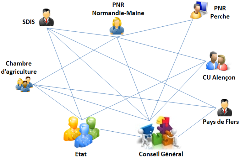
The “Open Orne” network of public partners
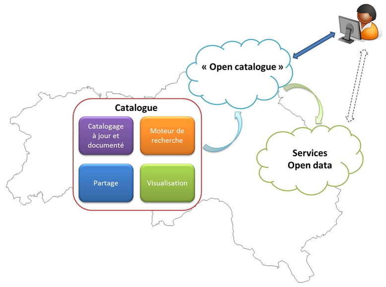
A downloading solution has been commissioned to distribute data defined as open and releasable. Geographical data will soon be consultable on the web-based map library (with DYNMAP GIS on the web).
“Open Orne” has been identified nationally as the only network of public partners ready for open data.